BY LEANDER C. DOMINGO
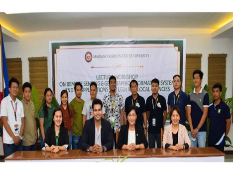
BATAC CITY (December 1)—Mariano Marcos State University (MMSU) in collaboration with Thailand-based Asian Institute of Technology (AIT) conducted a lecture -workshop on remote sensing and geographical information systems (RSGIS) to enable local sectors to mobilize data-based action.
Held at MMSU University Review Center on Nov. 24, AIT Program Officer Ranadheer Mandadi discussed the application of remote sensing technology in agricultural planning and production during the lecture-workshop attended by 50 representatives from local government units and agencies in Ilocos Norte, including MMSU personnel and students.
AIT is a leading postgraduate institution that excels in programs related to the environment, agriculture, information technology, engineering and RSGIS.
Mandadi explained that remote sensing uses satellite sensors to collect data images and provide specialized capabilities for manipulating, analyzing and visualizing those images. Remote sensed imagery is integrated with geographic information systems.
He said the lecture-workshop empowers participants as they plan and execute projects and policies in their respective units.
The lecture workshop was organized by the MMSU internationalization, linkages and partnerships directorate headed by Director Mee Jay Domingo, through its internationalization programs unit headed by Arlene Gonzales.
MMSU President Shirley Agrupis said the use of RSGIS can potentially benefit various sectors in the province, explaining that the conduct of the said workshop was to identify the needs and capabilities for them to collaboratively develop a customized capacity-building approach.
“This will eventually enable us to set up a system of space data access, sharing, and utilization,” Agrupis said.
Meanwhile, the Philippine Space Agency also conducted a workshop on Pinas (Philippine Space Agency Integrated Network for Space-enabled Actions toward Sustainability) project on Nov. 23 and 24, tackling the same topic.
